
San Rafael ZIP Codes by Area
San Rafael's common street-delivery ZIP codes are 94901 and 94903. The first serves central, southern, and eastern San Rafael contexts, including downtown, Canal, Gerstle Park, and Montecito. The second serves northern San Rafael, Terra Linda, Marinwood, Lucas Valley postal contexts, and Civic Center, while also reaching unincorporated territory. Postal city labels can therefore cross municipal lines.
| ZIP | Areas or context | Post-office context | Notes |
|---|---|---|---|
| 94901 | Central, southern, eastern San Rafael, downtown, Canal, Gerstle Park, Montecito | San Rafael delivery | Neighborhood lines do not define the ZIP |
| 94903 | Northern San Rafael, Terra Linda, Marinwood, Lucas Valley, Civic Center | North San Rafael delivery | Includes unincorporated areas |
| 94912 | San Rafael PO boxes | PO-box routing | No household street polygon |
| 94913 | San Rafael PO boxes and government mail context | PO-box routing | County and court mail can use it |
| 94915 | Unique or institutional San Rafael mailing context | Unique ZIP | Verify the individual addressee |
Nearby 94904, 94914, and 94960 can appear in the same regional search, but they should not be called San Rafael city ZIP codes without address-level USPS verification.
Note: A San Rafael ZIP code describes delivery routing; the table does not establish city limits or a resident roster.
Finding San Rafael Residents ZIP by ZIP
A ZIP code can narrow the first question, but it cannot choose a resident record by itself. Use it to sort known addresses or to check whether a mailing line belongs to a San Rafael delivery area. Then move to the address, APN, and custodian. The sequence keeps a postal label from being mistaken for a city boundary or household proof.
- Write down the full street address, unit, city, state, and ZIP shown in the source.
- Confirm the delivery ZIP with USPS, using Find by Address for one property.
- Use MarinMap to identify the parcel, APN, incorporated status, and nearby jurisdiction.
- Choose the city or county permit office from the boundary, not just from the postal city.
- Search the APN, deed index, permit file, directory year, or approved voter route that fits the goal.
A ZIP code directory is strongest as an intake tool. It helps sort addresses before the official record search begins.
San Rafael's 94901 and 94903 Divide
94901 and 94903 do not form a clean north-south city map. A 94901 address can sit in a neighborhood with a distinct history, and a 94903 address can sit in northern postal territory beyond the incorporated city. Terra Linda, Lucas Valley, Civic Center, Marinwood, and nearby communities make the ZIP useful for mail but incomplete for governance.
That geography affects records. San Rafael Community Development handles city permits. The Marin Community Development Agency handles unincorporated building, planning, environmental-health, and public-hearing records. MarinMap exposes jurisdiction layers and parcel attributes. The Assessor uses APN and map book. A ZIP search that skips the boundary check can send a request to the wrong keeper.
For street-level work after the ZIP narrows the area, the San Rafael street directory follows the address to APN and parcel records.
Note: The 94903 postal area crosses the city edge, so a ZIP match should trigger a jurisdiction check.
San Rafael PO-Box and Unique ZIPs
94912 and 94913 are PO-box routes associated with San Rafael postal service. They do not draw the same kind of household street polygon as 94901 or 94903. A court, county, or government mailing line may use 94913 even when the underlying site has another situs address. A PO-box record tells where mail is routed, not where a person lives.
94915 is a unique or institutional mailing context. Treat it as addressee-specific. USPS verification is needed before attaching it to a person, organization, or parcel. A ZIP code directory that treats every code as a neighborhood will overstate what the postal data can prove.
- ZIP code
- A USPS delivery-routing code that can cover a city area, PO boxes, or a unique mailing point.
- ZIP+4
- An added four-digit delivery segment that refines a postal address; it does not create a public resident list.
- PO-box ZIP
- A code used mainly for post-office boxes rather than a street-delivery polygon.
- Unique ZIP
- A code assigned to a particular institution or high-volume addressee context.
- Carrier route
- A delivery route within postal operations, not a municipal or property boundary.
Verify a San Rafael ZIP Address
The USPS city-and-state tool is a first check for accepted ZIP combinations. Find by Address is the better final check for one San Rafael property because it tests the full delivery line, not just the city name. Keep the output with the date of the check, then use GIS for the parcel and boundary.
The USPS screen below is the only successful ZIP-specific capture in the image manifest. It belongs in the postal verification step, before a resident or property record search.
Open the USPS ZIP Code Lookup to compare a city-and-state result with the address form.
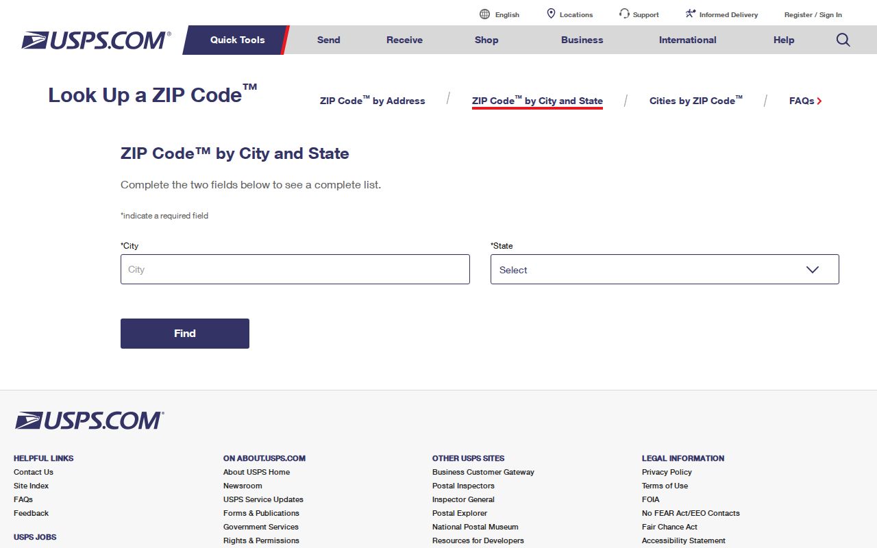
The form confirms postal routing. It does not establish ownership, occupancy, voter status, or city jurisdiction.
Note: USPS can confirm delivery routing, but ownership, occupancy, and municipal authority require separate sources and dates.
San Rafael ZIP and City Limits
A postal San Rafael line can point to a city parcel or to unincorporated Marin County. MarinMap's jurisdiction layer, the tax-rate area, and the permit custodian resolve that question. County guidance notes that tax-rate-area digits can help identify incorporated and unincorporated territory, but the live parcel and boundary should control.
City and county permits also have different timelines. San Rafael moved Community Development records from eTRAKiT to OpenGov in 2026. County records are organized through Building and Safety, Environmental Health, Planning, and Public Hearings. A ZIP code cannot tell which system holds the file.
Use MarinMap for the boundary and APN, then search the relevant city or county office.
Which San Rafael Tools Accept ZIP
Portals do not share one search design. USPS is built for ZIP and address validation. The Assessor is built for APN and map-book search. MarinMap can search an address or parcel and display a ZIP attribute in a service. City permits use address or APN. The Marin voter self-lookup guidance shows a person-authenticated form. The Recorder searches parties, documents, books, pages, maps, and dates. None of those last systems supplies a reliable ZIP-wide household filter.
| USPS | City/state ZIP and full address verification |
|---|---|
| MarinMap | Address or APN, parcel geometry, boundary, and map layers |
| Assessor | Parcel number in 999-999-99 form; map book and page |
| San Rafael permits | Property address, APN, old permit number, work and status |
| Voter status | Person-authenticated name, address, birth date, and ID fields |
| Recorder | Name, document number, book/page, map, date, and instrument type |
The asymmetry is the key point. A ZIP code directory can organize a set of known addresses, but the record trail starts only after the address is converted into the key required by its custodian.
There is no verified ZIP filter in the Marin Recorder index that produces a complete household set. Recorder searches use party name, document number, book and page, map, date, and instrument type. The assessor uses APN and map-book fields. A city permit search can accept an address or APN, while the voter form authenticates a person. Those different keys make a ZIP useful for sorting, not for replacing the source search.
San Rafael also lacks a simple standardized quadrant grid. Named streets, curved hillside roads, and subdivision patterns make a full address more useful than a ZIP alone. A delivery code may remain stable while a parcel, jurisdiction, or permit system changes. Save the original address line, the USPS result, the APN, and the date checked.
For a civic or family-history question, the next step can be a parcel, deed, directory year, or court record. The postal code should remain a clue in the notes, not the conclusion.
Note: ZIP-compatible fields differ by portal, so preserve the address and APN before changing record systems.
San Rafael ZIP to Street
Once a ZIP code narrows a search, stop using the ZIP as the main identifier. Preserve the full street line, unit, city, and delivery result. Compare the address with MarinMap. Capture the APN and jurisdiction. Then decide whether the question concerns a current parcel, a permit, a deed, a past directory entry, or one person's official record.
The same workflow prevents a common error in San Rafael: treating a postal city as proof that an address is inside the incorporated city. It also prevents a mailing address from being mistaken for a situs address. For family or house history, pair the parcel with a directory year, census schedule, Sanborn sheet, newspaper, and deed chain.
For current records, the parcel is the handoff point. It can lead to the city OpenGov search, the county planning viewer, the Assessor's APN record, or the Recorder's party index. For past residents, the parcel becomes a legal-description check against a directory street number. For a single person, the ZIP is only a location clue that must be tested against a court case, business role, or permitted voter route.
Keep a note of what the ZIP did and did not establish. It confirmed delivery context. It did not confirm ownership, occupation, household size, voter status, or the correct public office until GIS and the address record supplied more detail.
ZIP 94901 and ZIP 94903 also carry different research risks. A 94903 result can point toward northern San Rafael, Terra Linda, Marinwood, Lucas Valley, Civic Center, or nearby unincorporated territory. A 94912 or 94913 result is usually a post-office route, while 94915 needs an addressee-level check. Keep those codes in the worksheet as postal clues, not as parcel labels.
The city-and-state USPS result is not the same as the address-level result. Keep both separate from MarinMap's boundary and APN layer. Permit systems key on address or APN, My Voter Status authenticates a person, and Recorder searches use parties and documents rather than a ZIP-wide household filter.
The Marin Assessor APN search is the next step after the address and boundary are settled.